This article was created using a translator. There may be expressions that are difficult to understand. If you have any questions, please check by yourself.
Please consult us about anything related to Fujieda City.
CONTACTEach post town along the Tōkaidō has its own story, doesn’t it?
Towns nestled against mountains, towns that lived alongside rivers, towns that flourished as castle towns…
I’ve visited many post towns, but this time it’s Miyajuku.
Above all, Miyajuku is the gateway town to Atsuta Shrine.
It was also the starting point for the “Shichiri Ferry,” connecting Kuwana—one of the largest shrines along the Tōkaidō.
Here, land travel switched to sea travel, making it a vital transportation hub of its time.
The Shichiri Ferry (Shichiri no Watashi) was a sea route between Miyasuku (Atsuta Ward, Nagoya City, Aichi Prefecture), known for being one of the Fifty-Three Stations of the Tōkaidō, and Kuwanayado (Kuwana City, Mie Prefecture), serving as an official road in the past. Often, the term “Shichiri Ferry” specifically refers only to the ferry landing on the Miyasuku side or the Kuwanayado side of this crossing.
Although land routes were available during the Edo period, travelers deliberately chose the sea route despite its cost and maritime risks to shorten their journey time. As described later, the alternate route avoiding the sea was the Saya Kaido branch road, but it required a full day’s travel.
wikipedia(Japanese only)
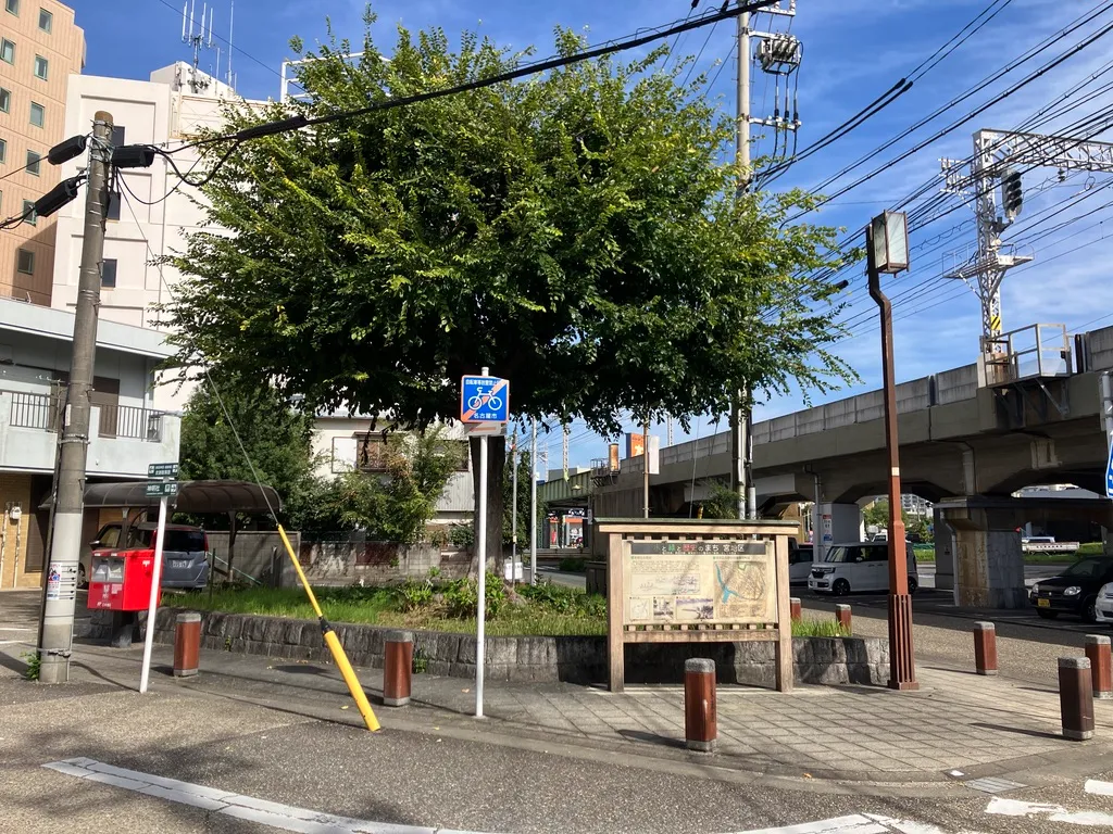
This time, we’ll introduce Miyasuku as a leisurely walking journey that includes the “Old Tokaido” and “Yobitsugi to Yamazaki” areas.
We’ve woven in historical tales and photo spots to make it a quick and easy read, so please enjoy it as if you were taking a stroll.
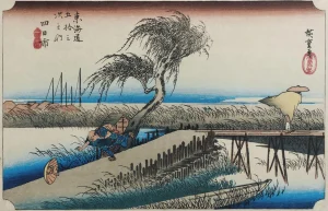
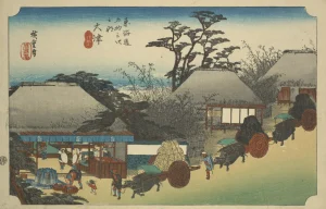
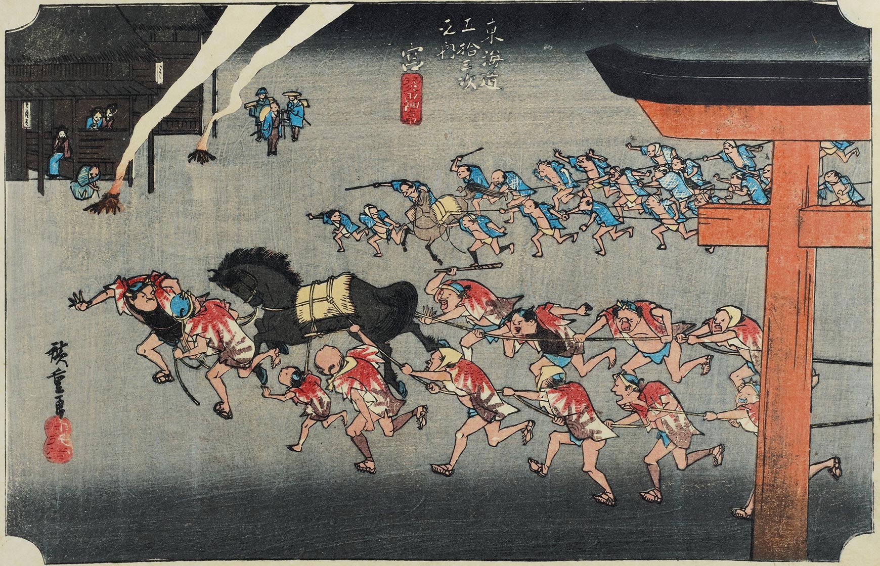
What kind of place is Miyajuku? — A post town protected by the sea and the shrine
The 41st station along the Tōkaidō was Miyajuku. For travelers walking from Edo, this was the “Gateway to the Sea.”
For those coming from the Kyoto direction, it served as a sort of “corridor” where they would visit Atsuta Shrine before returning to the main road.
Miyasuku truly flourished during the Edo period.
Especially after the Shichiri Ferry was established, it bustled with travelers, goods, peddlers, and pilgrims heading to Ise.
Boats departed in pairs as a rule. Amidst tides and seasonal changes affecting navigation, many people challenged the sea here—truly the “highlight of the journey.”
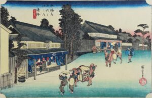
The post station itself seems to have been quite large.
- Two main lodgings (Red Main Lodging, Black Main Lodging)
- One auxiliary lodging
- Over 200 inns
It was one of the largest towns along the Tōkaidō. You can clearly see it was a town with all three elements: a temple town, a port town, and a post town.
Digging a Little Deeper into History — The Origins of Miyasuku and the Meaning of “Yozoku”
The origin of Miyasuku lies, after all, in the existence of Atsuta Shrine.
Since ancient times, it has been a center for “prayer” and “politics,” and by the Yamato period, it seems it had already become a key transportation hub connecting the eastern provinces with Yamato.
The areas spreading southward, like “Yobitsugi” and “Yamazaki,” were also important thoroughfares since ancient times.
By the Kamakura period, the Kamakura Highway (Kamakura Okan) already passed through, bustling with samurai traffic.
Furthermore, during the Warring States period, it was a tense border road where the forces of the Imagawa and Oda clans met.
That’s why this entire area…
- Stone monuments marking old road junctions
- Boundaries of feudal domains
- Road markers along highways and other vestiges of history remain scattered here and there.
Walking not just through Miyajuku but throughout this “Yobitsugi-Yamazaki area” gives you a sudden sense of clarity about the background of the highway.
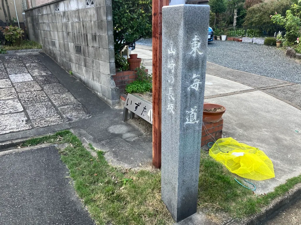
Yamasaki’s Nagasaka Monument
A simple stone monument stands on the long slope.
True to its name, it marks the “long slope” (Nagasaka), clearly showing how this area was once a difficult passage for travelers.
A spot where the city’s bustle fades a little, and the feeling of an ancient road suddenly grows stronger.
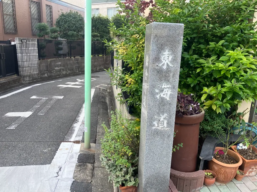
Crossroads Sign for the Kamakura Highway and Old Tōkaidō
This is what you might call an old intersection.
It’s a spot that gets history buffs a little excited—where the Kamakura Kaidō, the main route of the Kamakura period, meets the old Tōkaidō, Edo’s main artery.
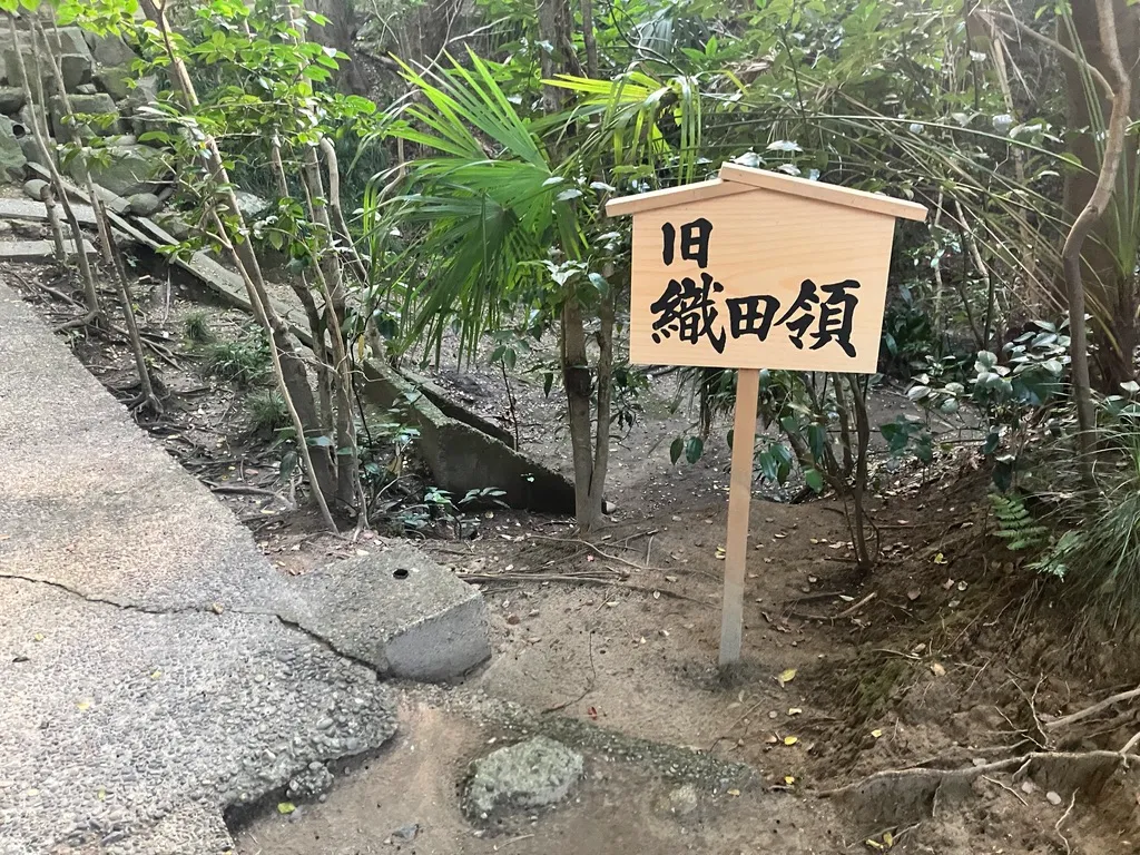
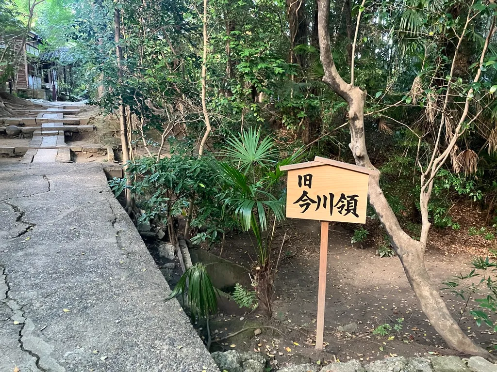
Boundary between the former Imagawa domain and the former Oda domain
During the Warring States period, this area was apparently right on the border.
The boundary between eastern Owari, under the control of the Imagawa clan, and central Owari, the Oda family’s stronghold, lay near here.
Now it’s just a quiet residential neighborhood, but it was once a tense frontline.
When I actually stepped foot here, it felt kind of scary. Though I admit I’m a bit of a scaredy-cat, haha.
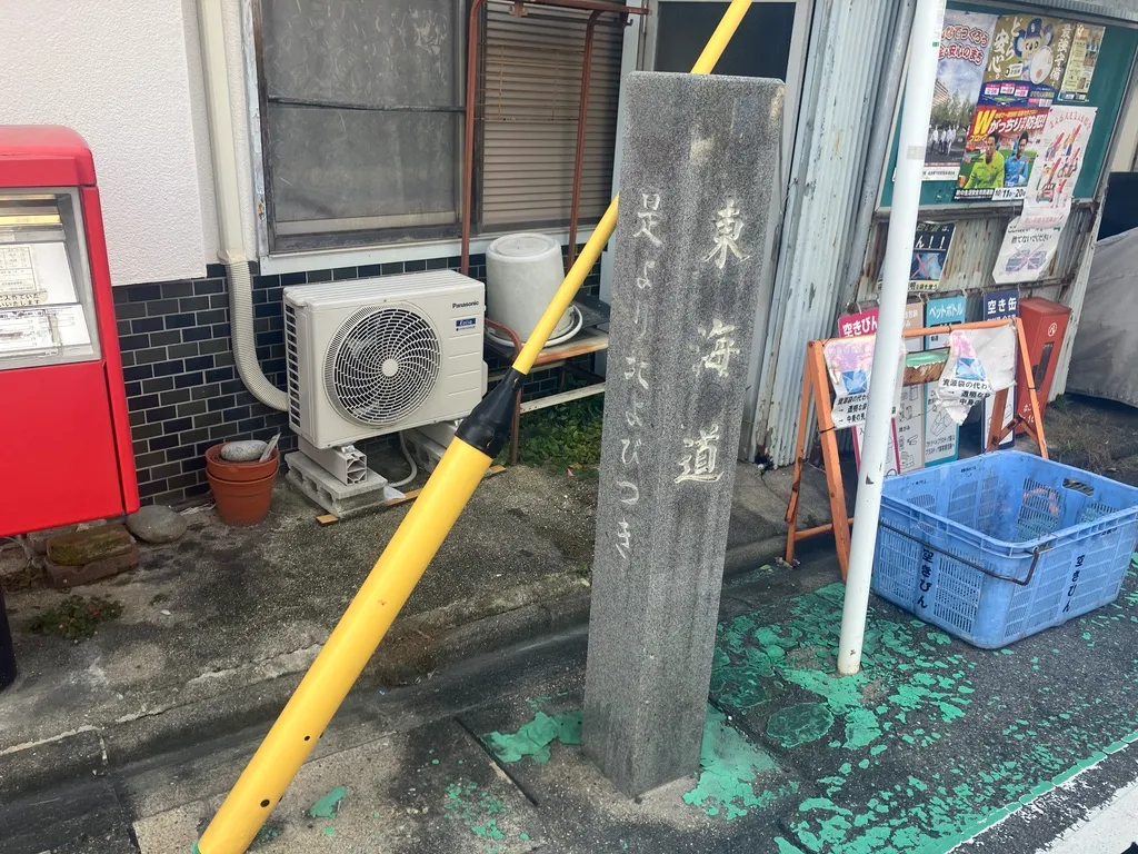
Old Tōkaidō Road Marker (From Here Northward)
“From Here Northward”——literally “From Here Northward, Call Continues.”
A road marker clearly indicating the region’s name, a remnant of the “gentle highway guidance” offered to travelers.
The carving of the characters and the stone’s texture are superb, making it a photogenic spot. It’s been called “Yobitsuki” since ancient times, you know~
Inariyama Chōraku-ji Temple
The temple made a sudden, striking appearance, its row of red torii gates leaving a vivid impression.
Deeply connected to Inari worship, travelers of old may have stopped here to pray for safe passage.
From here, one could reach the boundary between the former Imagawa and Oda domains.
Denmacho Mile Marker
The 41st milestone from Edo.
Now preserved as a stone monument, this spot once held a “road marker” that helped travelers gauge distances.
Just before entering Miyasuku, this is where the town’s atmosphere grows distinctly thicker.
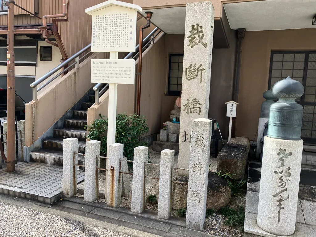
Site of the Saitan Bridge
A location where important bridges spanned the land from the Warring States period through the Edo period.
While there are various theories about the origin of its name, one suggests a nearby “place for sorting goods,” revealing it was a junction for transportation and logistics.
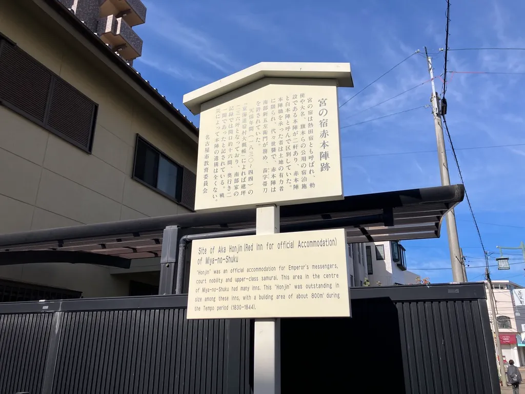
Kōshuku Site of the Southern Family of the Akimoto Clan
The symbol of Miyajuku’s center is this red honjin, the Nanbu family residence.
Honjin served as “VIP lodgings,” where daimyo, court nobles, and shogunate officials stayed.
The Nanbu family’s honjin is said to have been particularly prestigious even within Miyajuku.
Now, only a sign remains. Honjin sites often seem to be just signs, don’t they? 😭
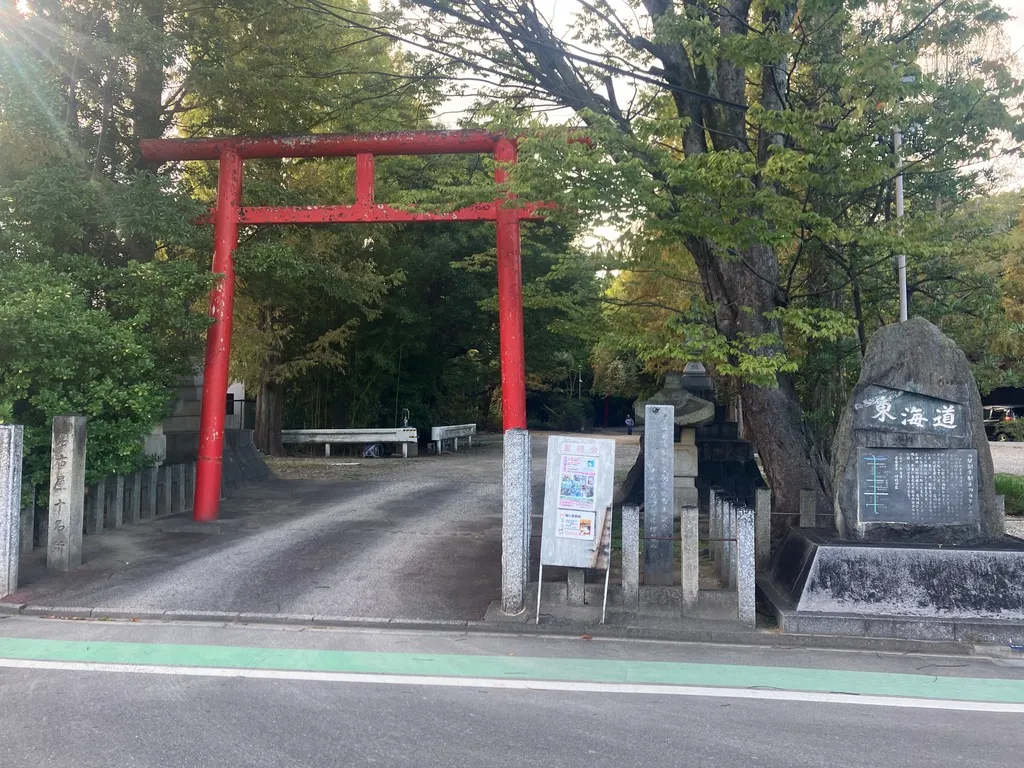
Miyano Watashi Park
When it comes to Miyajuku, you simply can’t miss this spot.
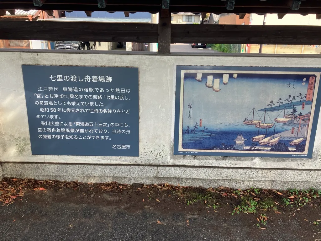
The departure point for the Tokaido’s only sea route, the “Shichiri Ferry,” is what is now Miyano Watashi Park.
What is Shichiri Ferry?
Walking the Tōkaidō from Edo, the overland route ends at Miyajuku.
From there to Kuwanajuku lies the “sea route”—a journey of about 7 ri (approximately 28 km) by boat.
This route held its own “drama of sea travel,” distinct from the overland path: departure times varied with wave conditions and tides, and poor weather could cancel crossings.
For travelers of that era, this place must have felt like the gateway to both tension and excitement.
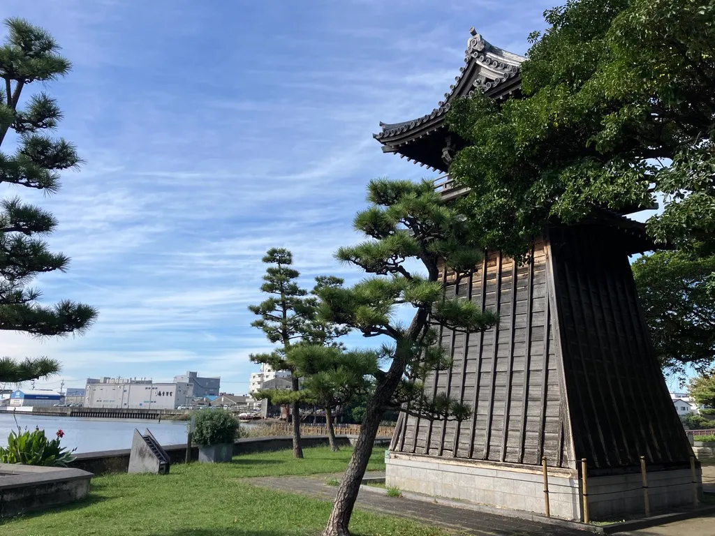
The appeal as a park
The current park is a tranquil space featuring a boat landing, an information monument, a nightlight, and rest areas.
The area near the boat landing is especially photogenic.
The shimmering water, the silhouettes of boats, and the vastness of Atsuta’s sky combine to instantly heighten that sense of travel.
It may not be flashy as a tourist spot, but thinking “This is where they set out to sea” makes it a truly heartwarming place.
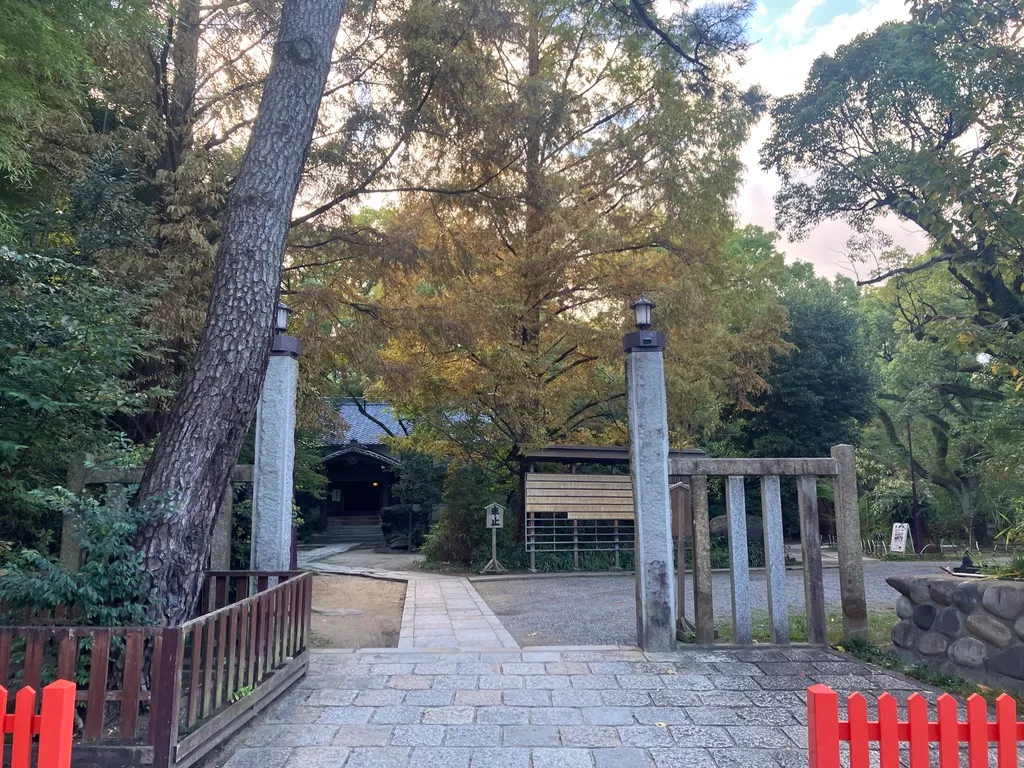
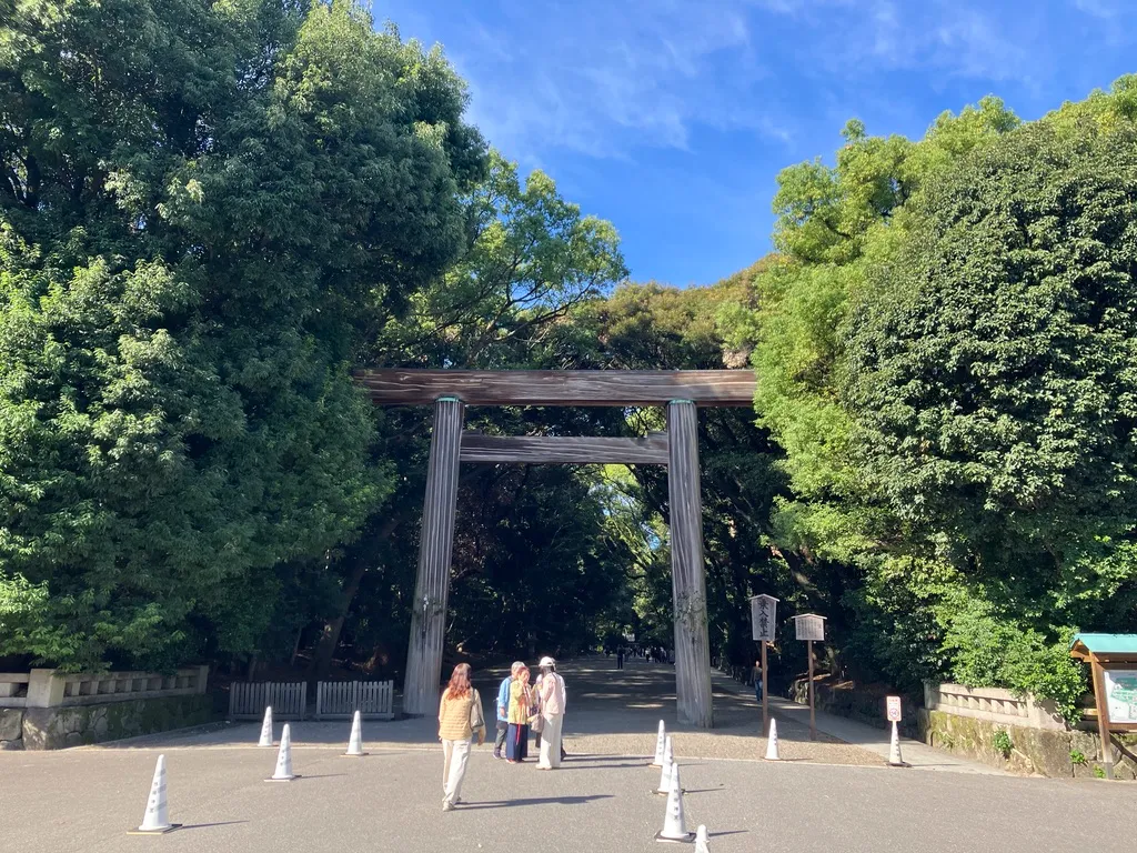
Atsuta Shrine
Last but certainly not least is Atsuta Shrine, the very heart of Miyajuku.
Why is it so important?
Atsuta Shrine is one of Japan’s foremost ancient shrines, enshrining the Kusanagi Sword.
It holds a status rivaling that of Ise Shrine and has been revered since ancient times as the “center of politics and prayer.”
For travelers along the Tōkaidō highway, the standard practice was “Upon arriving at Miyasuku, first pay homage at Atsuta,” making it a central destination for both sightseeing and religious devotion along the route.
Warriors like Nobunaga and Ieyasu also paid their respects here, and it was cherished as a place to make prayers before battle.
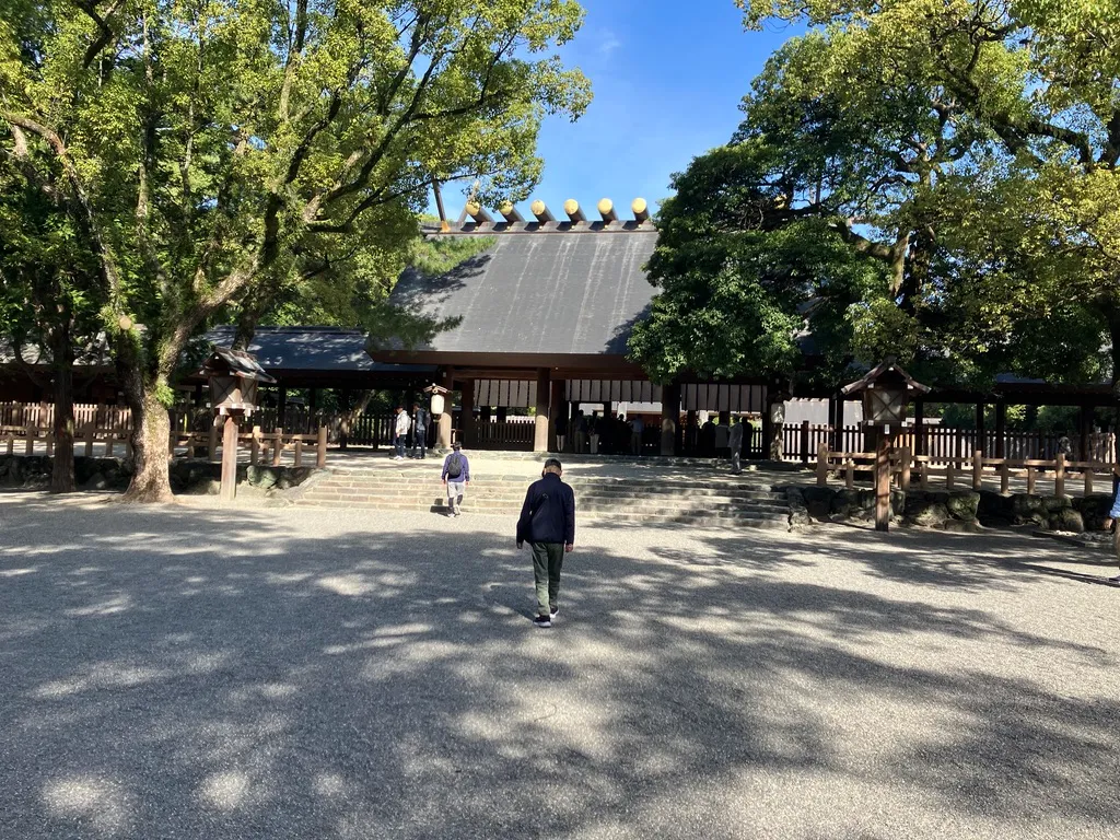
The Charm of the Temple Grounds
The moment you step into the temple grounds, the air changes completely, and the scent of the forest suddenly grows stronger.
That feeling is just irresistible.
- The majestic main shrine
- The refreshing approach
- The quiet grove
- History exhibits of Miyasuku
- Treasure Hall, etc.
There are many highlights, but the real charm lies in the atmosphere itself. “Majestic” is the perfect word for it. It might be hard to convey, but it’s that kind of atmosphere where you feel like you might get scolded… It’s hard to explain, isn’t it? 💦
No matter where you take photos, pictures at Atsuta Shrine turn out incredibly picturesque.
Sunlight filtering through the trees, gravel paths, shadows cast by the trees… Every frame you capture is perfect for your travel memories.
Summary
Among the post towns along the Tōkaidō, Miyasuku feels a bit special.
- Shrine (Atsuta)
- Sea Route (Shichiri Ferry)
- Ancient Road (Kamakura Highway)
- Border (Imagawa-Oda Boundary)
With so much history packed into this small area, it must have been a key point along the Tokaido Road.
Walking it in person, you’ll find plenty of photo spots, making your stroll along the old highway incredibly rewarding.
If you visit, I’d highly recommend this route:
Yobitsugi ~ Yamazaki → Miyajuku Center → Miyano Watashi → Atsuta Shrine.
- No.40 Walking the Tokaido “Narumi Post Town” ― A Post Town Where the Whispers of History and the Modern Townscape Blend Just Right
- No.42 Walking the Old Tokaido Road: Kuwana-juku From Kuka Park to Rokkaen, strolling leisurely in a travel mood
Author of this article
関連記事
-
 No.43 Walking the Old Tokaido Road: Yokkaichi Station A leisurely journey exploring the bustling history born from a merchant town
 -
No.42 Walking the Old Tokaido Road: Kuwana-juku From Kuka Park to Rokkaen, strolling leisurely in a travel mood
-
No.40 Walking the Tokaido “Narumi Post Town” ― A Post Town Where the Whispers of History and the Modern Townscape Blend Just Right
-
No.39 Chiryū-juku to Okehazama: A Leisurely Cycling Stroll
-
No.54To Sanjo Ohashi Bridge ― Walking from Yamashina to Kyoto’s Goal
-
No.53Otsu-juku – A Town Where Lake Biwa and History Intersect
-
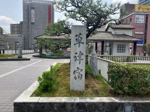
No.52 “Kusatsu-juku” – Walking Through the Post Town Where the Tōkaidō and Nakasendō Roads Meet –
-
No.25 Walking the Tokaido Road: Kanaya Station! Crossing the River: A Tour of Historical Sites and Landmarks Associated with Nakata Genzo